BARBONDALE
Route Information
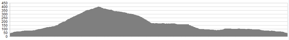
Stats: 10.5 miles, 1,800 ft of ascent
OS Map ![]()
Refreshments
Depending on season and time of day, there may be an ice-cream van at Devil’s Bridge but you’re not going to go hungry in 10½ miles, are you?
Character
This ride is added to celebrate Natural England’s decision to extend the Yorkshire Dales National Park westward. It’s a short spin, eminently suitable for an evening ride, but could be extended further west to make a longer ride.
Route
1. Park at Devil’s Bridge, the favoured stretching-spot for cramped motorcyclists, just outside Kirkby Lonsdale. Head east on the small lane that crosses the bridge (and must once have been the A65). At the top of a slight rise, turn left on a bridleway (marked Collier’s Lane) at the entrance to a caravan park. Follow this between the park and the golf course then, at the road, turn right on tarmac. Keep climbing, going straight over a couple of crossroads, heading towards Bullpot Farm.
2. At the farm, turn left down a well-signed bridleway. There’s been a bit of scramble bike damage so try not to add to it. There’s quite a rocky, technical descent into Barbondale – it forks near the bottom but both branches converge at the road. Turn right on the road, but only for a few metres before turning sharp left.
3. Barbondale is an idyllic picnic spot and there’ll likely be small children splashing in the beck. You can join in, as there’s a ford (there’s also a bridge for anyone keen to stay dry).
4. Follow the track down, staying on the true right of Barbon Beck. At a fork in the woods, keep left but don’t cross the stream. Too soon, the track emerges onto a swooping driveway so follow this down and to the left, near the small church.
5. Turn right at the road and then left at the Barbon Inn, following lanes back to Casterton. This allows you to return to Devil’s Bridge by the sunken bridleway you came up.
click below for gpx file


