Breasthigh Road
Route Information
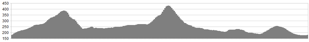
Stats: 9 miles and 1700 feet of ascent
OS Map: ![]()
Start point: Just before Roundthwaite, there’s a pull-in on the right. Or you could start at the A6 end. It’s your ride.
Refreshments
Tebay is your nearest commerce. Junction 38 services or The Cross Keys.
Character
Lovers of solitude will enjoy this one.
The mileage is only in single figures (you can extend it either south to join forces with The Other Borrowdale or venture north to make an ‘eight’ around Bretherdale and Nan Hill) But don’t be lured into complacency – there is plenty of climbing and plenty of tricky terrain to negotiate. There are no easy miles in these ‘ere parts. In our case, the intended ‘eight’ was cut short by a tumble on the decent into Bretherdale that left both bike and rider requiring medical attention.
‘Breasthigh’ is actually a double misnomer. First, because of the connotations of softness and smoothness. In reality, this pass is rough. Really rough. Start with the obvious simile of the badger’s arse. Now imagine a particularly unfastidious badger, after a night out on Poppadums and Jalfrezi, equipped only with a rusty rasp file for personal hygiene. It’s rougher than that.
As a consequence, the second impression, that of sinking in chest-deep mud, is also false. The pass is all stone-based so mire is not an issue. Parts of the first leg, over Roundthwaite Common, however, could be marshy after a damp spell.
One notable feature of the area is the profusion of wildflower meadows – huge, dizzying expanses of buttercups, campions and dog-daisies. You should see skittish wild horses on the heights, among the meadow pipits and wheatear. In Borrowdale, look out (and listen out) for stonechats tocking alarm from the gorse and bracken.
Route
1. There’s a good Bridleway sign, saying “Borrowdale” just before the farm. No, they don’t mean that Borrowdale. Climb, initially steeply, to the left of a tight stand of sycamore. Pick up a good track, surprisingly dry, up the flank of Jeffrey’s Mount, with a fine retrospective of the Balamory colours of Tebay
2. Where the wall turns 90 degrees right and a track veers up to the left, go straight ahead. There’s a small water splash with a tough but short climb beyond.
3. The track loses some of its identity here, so be prepared to strike a sou’westerly bearing, crossing the ridge to the left of Belt Howe.
4. Rollick on stony zig-zags down to Borrowdale.
5. Head up the valley. The map would have you believe you can keep to the northern (true left) bank but it’s easier to cross at the obvious bridge and follow the south bank to the stepping stones. Either cross these or splash the ford.
6. It’s a tough climb but surprisingly do-able as long as you can maintain traction on the rubble. It doesn’t go on as long as you might think, either.
7. There now follows a really stony descent into the seldom seen valley of Bretherdale. Watch out for this descent – I came a purler here and am currently nursing a number of injuries.
8. Trundle down the valley and turn right at the end for the short climb up Pikestone Lane back to the start.
click below for gpx file


