Dallowgill
Route Information
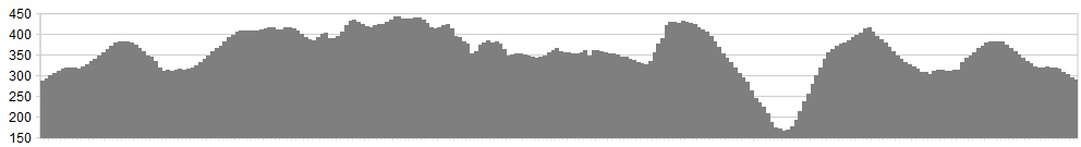
Stats: 25.5 miles
OS Map: ![]()
Refreshments
For me the best spot is indeed Masham. Ample accommodation, places to eat and drink. On the way around, Lofthouse provides suitable liquid refreshments at the excellent Crown Hotel. Their food is also superb – but a steep climb will follow, so take it easy.
Dallowgill, near Masham (parking for Mossaic Trail). From Dallowgill village drive along and take the road left and over the moor marked ‘unsuitable for motor vehicles’. Head up the narrow road and locate the parking to the right. Slightly farther ahead, a more picturesque spot exists by a small waterfall. The latter parking spot knocks over a mile off the round trip and makes it a better finish, without any tarmac . This is an excellent ride, with a easy incline to begin, followed by a superb descent on a rocky bridleway.
Character
The views are spectacular as the routes crosses moorland tracks and rises and falls with spectacular descents being the reward for hard climbing all day long.
Have a break and a bite to eat at the pub in Lofthouse before climbing back up on the edge and a superb finish to an excellent ride.
Route
1. Ride up the road and onto the moorland track eventually meeting a gate. The track now descends on rocky loose gravel to a junction with a bridleway to the right.
2. Turn right and follow this until the track splits. Take the right hand fork.
3. Continue up a steady climb until a ‘T’ junction of tracks. Turn left and head towards Lofthouse, keeping right at the next major track junction and head to the tarmac road.
4. Crossing the road, take the bridleway which stays up high above the valley edge and follow this around the valley, up several small climbs and descents and through a series of gates.
5. As Scar House Reservoir comes into view and you see the car park away off to your left in the distance, the moorland track decsends extremely steeply on loose gravel. Take care with speed and brakes at this point, and save your energy for the climb out!
6. A final descent takes you down to the reservoir and the track is followed around the reservoir and over the Angram dam wall, turning left and following the tarmac road to the picnic spot and car park.
7. Just before the toilet block a track heads up on the right. This is steep, loose and twisty, but opens up on the top to a glorious descent along Moor Lane to Middlesmoor, through the village, joining the road to Lofthouse.
8. At Lofthouse head up the road signed Masham, where at the top of the climb a bridleway to the right heads off back to Dallowgill.
9. Keep to the right hand track until familiar ground brings you to the first track junction. Head up the climb and back to Dallowgill.
Enjoy a refreshing break by the waterfall and stream.
click below for gpx file


