Ingleborough
Route Information
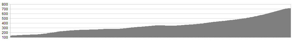
Stats: 6 miles, 1750 feet of ascent
OS Map: ![]()
Refreshments:
None on the hill but Bernie’s is well worth a stop.
Character
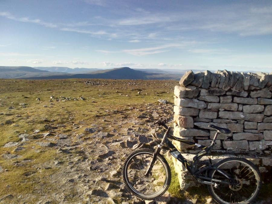
Unclassifiable because it’s a very short route, half of which is very easy and half of which is a wild testing ground. I can categorically state that the last few steppy sections to the summit are totally unrideable to mortals. I don’t care if you post a link to a YouTube clip of you and your mates rattling down it; anything can be faked with CGI these days. Just look at those moon landings… Even as a dead weight, it’s worth lugging the bike up to the top for the triumphant pictures by the cruciform shelter.
There is limited parking on the Blea Moor road as you leave Ingleton.
Route
Unnecessary really, because the route is never in doubt. Start up the steep farm track, follow the drove road to the right fork just before Crina Bottom, and keep pedaling as long as legs and lungs allow.
This is a straight up Ingleborough route, so a gpx file is unnecessary


