Thieveley Pike, Lancashire
Route Information
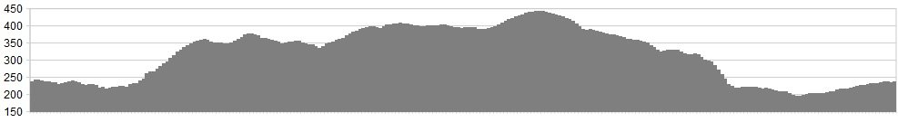
Stats: 11 miles and 1250 feet of ascent
OS Map: ![]() Refreshments
Refreshments
Todmorden and nearby Hebden Bridge would be our choices.
Character
This short excursion into the wild lands between Yorkshire and Lancashire includes two deliciously overstated place names. Anyone expecting Thieveley Pike to be a soaring pinnacle will be disappointed, just as a prior visitor to the Verdon will question whether the Cliviger valley really counts as a “gorge.” But context is all and it is certainly a dramatic cleft, in Pennine terms. The Pike is an unassuming swell of moor rendered dramatic by the crenelated edge overlooking the gorge.
Route
1. Ride south-east on the A646 to Cornholme.
2. Just as you enter the village, fork right into Carr Road. Climb for about 2 miles to a moorland plateau.
3. Double back to the right on Flower Scar Road. This climbs up the moor but we fork left onto a sketchy trail across the north-facing flank.
4. At places, there is just a series of short posts (in varied colours of blue, yellow and white) to guide you. Look out, too, for incongruous interpretation boards for the Todmorden Moor Geology Trail and some industrial history of the mining activity here. The distinctive buildings down on your left are part of an observatory.
5. Drop to the A681 Bacup road and climb briefly to the right.
6. When the road dinks left and drops, turn right towards the less-than-scenic landfill site.
7. Turn left near the power lines, towards a remote farmstead. Follow this line for a mile or so.
8. Climb up to the right to gain the trig point at Thieveley Pike. Follow the watershed to the A671 Burnley Road.
9. Follow the new bridleway alongside the road, ignoring the track flanking the moor on your right.
10. Instead, take the lower track towards the even-more-remote farm at Cow Side but bypass this on the left.
11. Drop on grass from the Mary Towneley memorial, noting the ingenious fencing to keep your front wheel out of the rabbit-hole traps.
12. Zig-zag down to the right, crossing the railway to Holme Chapel.
13. Turn right to regain the start point.
click below for gpx file


