
 Tobias Arweiler
https://pedalnorth.com/wp-content/uploads/2026/03/tobias-arweiler-wHnUcwgTxKQ-unsplash.jpg
1106
1920
Pedalnorth Website
https://pedalnorth.com/wp-content/uploads/2026/02/Pedalnorth-final-logo-and-wording-for-February-2026.svg
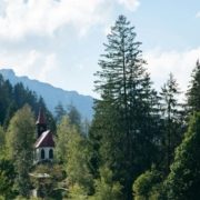
Pedalnorth Website2026-03-05 12:18:482026-03-05 12:22:53Schattwald and the Tannheim Valley gravel ride – in the Austrian Tyrol
Tobias Arweiler
https://pedalnorth.com/wp-content/uploads/2026/03/tobias-arweiler-wHnUcwgTxKQ-unsplash.jpg
1106
1920
Pedalnorth Website
https://pedalnorth.com/wp-content/uploads/2026/02/Pedalnorth-final-logo-and-wording-for-February-2026.svg
Pedalnorth Website2026-03-05 12:18:482026-03-05 12:22:53Schattwald and the Tannheim Valley gravel ride – in the Austrian TyrolIf you stayed over at Rosedale, then a climb up the bottom section of Rosedale Chimney is enough for anyone. The short tarmac section does however lead to some of the best singletrack in England and will give a thirst for more.
A sweet section of singletrack leads on towards Dalby Forest, unless you stayed the night nearby, now being able to start the day on the world famous red route.
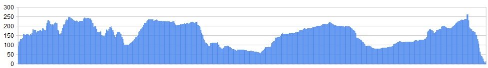
Distance: 42 miles (including full Red Route at Dalby)
28 miles if taking direct moorland route
Ascent: 3522 ft
The stage finishes off with a climb up to the coast, before dropping down to the sea and dipping the wheels!
OS Map: ![]()
Character
This could well be the last day of riding folks; a long day if you stayed at Rosedale overnight, then the red route at Dalby as an option. It starts with a skip up onto the moors to some of the finest singletrack anywhere, before dropping in on the world class red route. It’s up to you how much of the route you tackle at Dalby, but it’s a worthy diversion.
By now you’ll have ridden nearly 250 miles across three National Parks, taking in some of the finest tracks that they have to offer, and visited two of the best trail centres in England.
Alternatively, once you’ve negotiated Cropton Forest, you can simply stick to the moorland tacks and ride across the expansive heather clad moors to Robin Hoods Bay, hardly hitting a road all day long. The choice is yours – Dalby option or the northern moors option.
Hopefully you’ll have some memories to last you a lifetime. WELL DONE! This is a hard C2C ride for anyone, and only the brave and the tough riders will complete it. Dropping down the track towards the sea you should have a big wide grin on your face. Have a drink at the beautiful coastal village of Robin Hoods Bay, you’ll have earned it – but we’re not buying!
Route
1. (From Rosedale stopover) Now to head to the coast, taking in some great forestry riding at Dalby on route. But first we have some more of the best singletrack in the UK on offer. Climb Rosedale Bank to the hotel. You may need to walk up this! It’s England’s steepest road! Take the bridleway off to the left, passing Bank Farm and a cattle grid en route to the bridleway junction at Hollins Farm. Take the singletrack that skirts the edge of the moor undulating along divine moorland riding until it eventually gives way to a track which leads to tarmac at Lower Askew.
2. Follow the road down to Cropton, then turning left at the village green and following the narrow lane signed for ‘Sutherland’ and ‘Newton’. Approximately 2.2 miles along this lane, the road turns sharp left, with a cul-de sac directly ahead. Stay ‘straight ahead’ following the rough track of the cul de sac for a further 0.7 miles.
The Dalby Forest Option
3. A short distance further on a ‘T junction’ track is reached – turn down right and follow this track until it joins the main road by Yatts Farm. Turn left and immediately right, into Ruddings Road, a hedgerow lined flat lane that will speed you along towards Dalby.
A crossroads of tracks is reached next. Go straight on, following this track as it crosses the North Yorks Moors Heritage Railway, turning right almost immediately once across the tracks, skirting left as a copse of trees is reached, following the BW with the trees now to your right, then across to meadow towards Crossdale Road (track). A reassuring sight will be Farfields Farm bed and breakfast to your left. Turn left at the main road where you will see the Fox and Rabbit Inn (possible halt nearer Dalby). Having turned left, take the next right and follow the track down into Dalby Forest, to the visitor centre and start your fun on the red route.
We haven’t described the red route directions, as you simply have to follow the well signed route and end up again at the visitor centre for a break before heading to the coast!
To the coast!
4. From the Dalby Forest visitor centre head along the road towards the ‘Go Ape’ climbing area, turning into the track next right after this. Head up and out of the forest via Givendale Head Farm, turning right after the farm onto the lane, then turning left into the wide lane/ track a few hundred metres further along (Oxmoor Dikes on OS map). Stay on this for 2.3 miles, crossing over a lane along the way and keeping the woodland to your left.
5. The track meets a tarmac lane (Cockmoor Road) in among Wykeham Nursery. Turn right and immediately left on the further rough track and descend to the road by Troutsdale Lodge, then turning right. Stay on this lane for just under 1.5 miles, then turning into the lane on the left which will lead you to Langdale End.
6. Enter Broxta Forest and ride through for 2.5 miles to the viewpoint and car park near Reasty Hill (OS Maps). At the road turn left and cycle along until this narrow road joins with the A171 trunk Road close to Ravenscar and the disused railway that takes you to the sea at nearby Robin Hoods Bay!
7. Turn left onto the A171 and cycle for 1 mile, then turning onto the bridleway on the right, following this across moorland scrub until it exits you onto the disused railway line that leads you along the coast a few miles to the beautiful seaside hamlet of Robin Hoods Bay, where there’s ample places to stay, to eat and drink. Cycle into this small coastal village and wander down to the sea to dip your feet into the sea – well done!
The northern Moors Option
If however, you don’t want to take on Dalby today, then this option leads you from Cropton Forest and across the Moors, directly to Robin Hoods Bay and the sea. It’s a shorter day and a better option if time is a consideration.
3a. Exit Cropton Forest at the northern edge, at Wardle Green, and pick up the track towards Goathland (across Simon Howe Rigg). Pass the standing stones and cairn, and then the climbing starts to descend, thankfully.
4a. Descend ‘Two Howes Rigg’, crossing the footbridge near Collinson Beild (OS Map), and head all the way to the narrow road. Turn right and ride down towards the Whitby Road (A169) at Ellerbeck.
5a. Follow the bridleway east, crossing open moorland, to the track junction at Lilla Howe (OS map). Pick up the bridleway heading north-east, signed the ‘Robin Hood’s Bay Road’, and ride along this to the A171 trunk road. Turn right and ride along the road for a short distance, picking up the bridleway on the left towards St. Ives Farm and Bridge Holm Lane.
6a. Just before Bridge Holm Lane, the disused railway cycle track is reached. Turn onto this and ride the last short section to Robin Hood’s Bay. It’s then an easy ride down the hill that runs through this beautiful coast hamlet, all the way to the sea. Robin Hood’s Bay has ample places to eat, eat and drink and accommodation choices. Time for a drink 🙂
Unlike Wainwright, we won’t be offering you a pint… buy your own!
Click below for gpx file & accommodation

Dalby Forest Option
Direct Option over Moors
RELATED CONTENT
Tobias Arweiler
https://pedalnorth.com/wp-content/uploads/2026/03/tobias-arweiler-wHnUcwgTxKQ-unsplash.jpg
1106
1920
Pedalnorth Website
https://pedalnorth.com/wp-content/uploads/2026/02/Pedalnorth-final-logo-and-wording-for-February-2026.svg
Pedalnorth Website2026-03-05 12:18:482026-03-05 12:22:53Schattwald and the Tannheim Valley gravel ride – in the Austrian Tyrol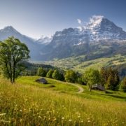 https://pedalnorth.com/wp-content/uploads/2025/10/Grindelwald-and-Eiger-image-by-davidbirri-22d0xgfemt7366w.jpg
1708
2560
Pedalnorth Website
https://pedalnorth.com/wp-content/uploads/2026/02/Pedalnorth-final-logo-and-wording-for-February-2026.svg
Pedalnorth Website2025-10-13 16:07:232025-10-13 16:32:51Grindelwald Eiger Gravel Epic Route
https://pedalnorth.com/wp-content/uploads/2025/10/Grindelwald-and-Eiger-image-by-davidbirri-22d0xgfemt7366w.jpg
1708
2560
Pedalnorth Website
https://pedalnorth.com/wp-content/uploads/2026/02/Pedalnorth-final-logo-and-wording-for-February-2026.svg
Pedalnorth Website2025-10-13 16:07:232025-10-13 16:32:51Grindelwald Eiger Gravel Epic Route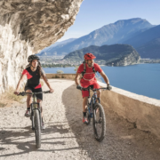 https://pedalnorth.com/wp-content/uploads/2025/09/Tremalzo-MTB-round-tour-Garda-website.webp
1164
1920
Pedalnorth Website
https://pedalnorth.com/wp-content/uploads/2026/02/Pedalnorth-final-logo-and-wording-for-February-2026.svg
Pedalnorth Website2025-09-11 20:35:432025-09-15 09:43:32Italy and the Tremalzo MTB tour
https://pedalnorth.com/wp-content/uploads/2025/09/Tremalzo-MTB-round-tour-Garda-website.webp
1164
1920
Pedalnorth Website
https://pedalnorth.com/wp-content/uploads/2026/02/Pedalnorth-final-logo-and-wording-for-February-2026.svg
Pedalnorth Website2025-09-11 20:35:432025-09-15 09:43:32Italy and the Tremalzo MTB tour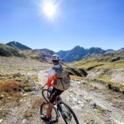 https://pedalnorth.com/wp-content/uploads/2025/09/Alex-on-Stelvio-mtb-route-2025-.jpg
1920
1440
Pedalnorth Website
https://pedalnorth.com/wp-content/uploads/2026/02/Pedalnorth-final-logo-and-wording-for-February-2026.svg
Pedalnorth Website2025-09-08 16:01:012025-09-09 09:23:03Stelvio Pass gravel and mountain bike route – unpaved
https://pedalnorth.com/wp-content/uploads/2025/09/Alex-on-Stelvio-mtb-route-2025-.jpg
1920
1440
Pedalnorth Website
https://pedalnorth.com/wp-content/uploads/2026/02/Pedalnorth-final-logo-and-wording-for-February-2026.svg
Pedalnorth Website2025-09-08 16:01:012025-09-09 09:23:03Stelvio Pass gravel and mountain bike route – unpavedKIT PARTNER
TECHNOLOGY
Tech Partner
Road Bikes
Off Road
Bike Packing
Life Cycle E-Mag
