
Tyne River Loop
Route Information
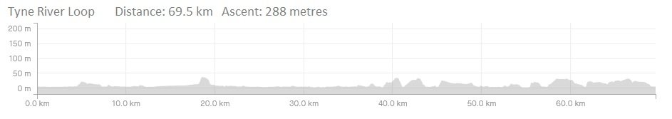
Stats: 44 miles and 860 feet of ascent
OS Map: ![]()
Refreshments
Cafes at: Wylam, Blaydon, Baltic Quay, South Shields, Ouseburn
Character
A quiet, mostly off-road loop along both banks of the river Tyne, using a mixture of some road, cycle paths and cinder track, along former railway routes and maritime industrial areas which have been converted to inner city parkland using the National Cycle Network routes 72, 141 and 14. Suitable for MTB, Hybrid or cyclo-cross.
Route
1. Exit the Hub and turn left onto NCN 72, Hadrian’s Way which goes along Newcastle Quayside, under the Tyne Bridge, then on Scotswood road.
2. Leave the Hadrian’s Way at Newburn Riverside with a left turn at the roundabout, then left onto the river path.
3. Rejoin NCN 72 after Newburn Industrial estate and through the park and on past George Stephenson’s birthplace to Wylam. Go through the village and cross the Tyne on the old railway bridge at Hagg Bank, which was the original prototype for the later Tyne and Sydney Bridges.
4. After the bridge, turn left then left again, following the road over Hagg Bank, turn left, cross the railway then turn right into the station car park and join NCN 141, Keelman’s Way, and follow it along the Golf course to Ryton, then Blaydon.
5. After Blaydon station the route continues through the industrial estate to meet the river again, then crosses the mouth of the river Derwent where the route becomes NCN 14.
6. Cross the mouth of the Derwent River and pass the Metrocentre, then cross the road at the traffic lights and right into Dunston. Turn left at the Tudor Rose Pub and follow the new section of the route round the river edge and onto Gateshead Quayside.
7. At the Swing Bridge turn right then left and go under the Tyne Bridge once more, past the Sage concert centre and past the Baltic Centre for contemporary art.
Continue on NCN 14 along South Shore Road and onto Felling Shore path, through the industrial estate and then Bill Quay City Farm and on through Hebburn riverside park.
8. A small bank up to the church then left along the shipyard road to Jarrow then a left onto Jarrow Slake.
9. Join the path alongside the main road then a left to South Shields for the ferry to cross the river.
10. On the other side join NCN 72 again, up the bank and around Royal Quays Marina, through Howden and along the old shipyard rail line, Walker riverside park and back to Ouseburn.
Click below for gpx file

