Riding the Cormet de Roselend
The Cormet de Roselend is a superb classic Alps road cycling route, with local knowledge provided by our friends at TagRide in France, it’s definitely a route to enjoy.
At 1967 m, this high alpine pass in the Savoie provides awesome views, as you cross to beautiful Alberville and stay the night, before heading off elsewhere on your cycling tour of the Alps.

Route Information
Stats 71.49 km 1429 metres
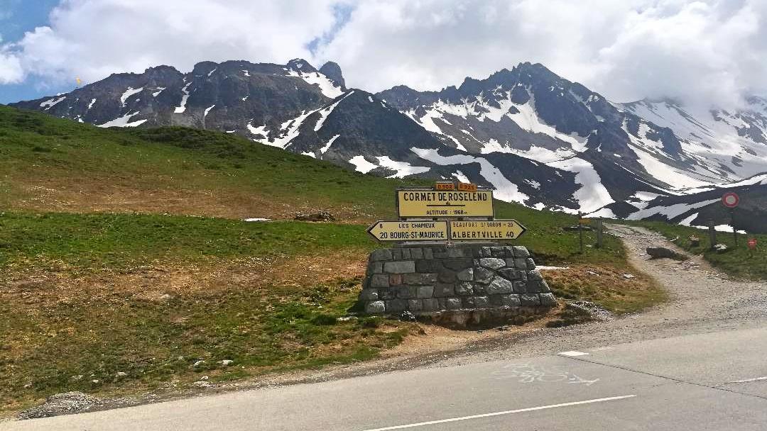
Sitting at an altitude of 1968m the Cormet de Roselend connects Beaufort(744m) in the Beaufortain valley in the west and Bourg-Saint-Maurice(840m) in the Tarentaise Valley to the east.
The climb has a rich TDF history. It was first featured in the 1979 Tour de France and ten times since. In 2019 the climb was cut from the tour as a mudslide rendered the climb impassable.
It returns in 2020 for stage 18 and just happens to follow our preferred route over the Cormet!
Character
A beautiful but challenging Alpine col with stunning views of Roselend Dam and the Combe de la Neuve valley that requires stamina on the climb and demands respect on the descent. The Cormet can be approached from either the east or west aspect, and at the summit either turn around or continue over to descend the other side. The climb is equally tough, averaging 6.0% in both directions with sections reaching 10% from Beaufort and 9% from Bourg-Saint-Maurice.
Both east and west aspects of the pass have their own particular charm and challenges.
We prefer to cross it from east(Bourg) to west(Beaufort). The views offered as the valley opens up with every marker passed on the ascent from Bourg make the climb all the more rewarding and the combination of the superior surface and more flowing nature of the road make for a more enjoyable and safer descent to Beaufort (one only has to think back to Johan Bruyneel’s terrifying disappearing act over the edge of the Cormet on Stage 7 of the 1996 TDF whilst descending to Bourg to know what we mean).
Refreshments & Where to Stay
This route offers many options for breaks and refreshments. Aime, Bourg, Beaufort and Albertville in particular offer up a variety of restaurants; but it would be remiss of you not to stop to enjoy a famous Beaufort tart in this delightful riverside town.
There are two restaurants situated at the lake offering wonderful views, but we prefer to carry on down to the lovely town of Beaufort and enjoy refreshments in one of the river side cafes. Watch out for the green water fountains in Beaufort that resemble little fire hydrants, to refill your bottles here! Once you’ve left Bourg there is no opportunity to refill water bottles until you have reached the lake. You will find a water tap behind the bins at the end of the lake on the way down to Beaufort.
Route
1.We recommend starting this route in the picturesque riverside town of Aime at an altitude of just over 650m, at the carpark on Rue des Iles. It is here you will join the cycle path that follows the Isere for around 13km, gently climbing up to bourg St Maurice at 840m. The river keeps you cool on hot summer days and the gentle path allows you to warm those legs up before the start of the mountain road.
(But of course it is possible to start further down the valley. However the road is busy before this and not particularly pleasant to cycle)
2. At Bourg we come off the cycle path and things heat up as we get straight on to the Cormet and the climbing begins.
3. We follow the D902 up through some small villages and into the forest that offers up some welcome shade.
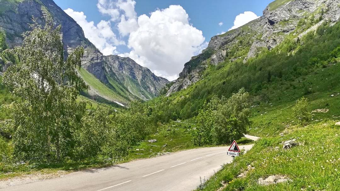
3. 7km on from Bourg and you reach probably the toughest section of climbing, knuckle down for 10 classic alpine switch backs laid out over 2.5km of alpine tarmac.
4.Switchbacks completed, the road opens up into the valley ahead and you are rewarded with a flattish 2km. Enjoy the wonderful views of the Valley des Glaciers and Les Chapieux.
5. With 7-8km left to the top of the pass there is still some tough climbing to go, but you are rewarded with spectacular views with every corner turned until reaching the top at 1968m. Stop to catch your breath, take in the wonderful scenery and take a picture in front of the famous col marker.
6. From here on in it’s (nearly) all downhill as they say on the D925, and 4km of flowing road leads us to a sweeping left hand bend that opens up stunning views to the dam below.
7. The road sweeps around the top end of the lake for 3km before swinging off right to the descent to Beaufort. The surface improves from here and flows nicely, allowing you to let off the brakes between switchbacks. However, the views into the Beaufortain Valley are definitely worth applying the brakes for to take a minute to enjoy the vistas.
8. From Beaufort we continue down the D925 dropping roughly 400m over 20km to the town of Albertville.
If you were feeling very Spritely, then the col de Saisse starts from Beaufort but we ll leave that for another day/route 😉