Ulpha Fell
Route Information
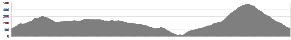
Stats: 14 miles and 2,430 feet of ascent
OS Map: ![]()
Refreshments
The miles of windswept moorland are refreshment enough, right? There’s not a lot of commerce over these parts.
Character
There are plenty of people who will tell you that the Lake District is just too full and too commercialised – an endless parade of concession stands selling achingly tasteful Peter Rabbit coasters and ‘Daffodils’ tea towels. The fault, of course, lies with their lack of imagination rather than Lakeland itself, which can hardly be blamed for an excess of charms. The fact is, 863 of the 866 square miles in the National Park aren’t Grasmere, Ambleside or Keswick and 46 weeks of the year aren’t the school summer holidays. This ride epitomises what the seeker of unspoiled solitude can find, if willing to pay the price. That price involves driving another 15-or-so minutes to the starting point and being ready to navigate vast tracts of damp moors with only sketchy evidence of people’s passing.
Start point: If you’re arriving in the district by car, there’s a tiny quarry with room for one vehicle at 186924
Route
1. There’s a granny-ring pull up the road to start; no warm-up for us, my friend. Pass the ruin next to Old Hall Farm and turn right to Hole House.
2. After Hole House, you reach a faster with a letter-box. The main track loops back on itself up to the right but take a left on the speed of the curve to pick up a distinct but unsigned bridleway.
3. Climb to a level terrace and follow this north but not too far. Long before the level terrace reaches a gate, flank up to the right, aiming for the saddle between The Pike and Hesk Fell.
4. A soft descent ensues, holding a nor’easterly bearing down to the road.
5. Head north west on the road and fork left after a mile towards Woodend (no signage)
6. At Woodend, follow the helpful diversion to the south that avoids intruding on the farmer’s home. Then stare down the enormous bull (Christmas 2013) and set of across the open fell. When the path gets sketchy, head towards Devoke Water and pick up a reasonable bridleway along its southern shore. If the clouds are lowering and the spume flying, it’ll feel more like a lonely lochan than a Lakeland tarn.
7. As you leave the water behind, pass just to the left of a cairn then keep to the left of a subtle, cairned ridge, heading towards a distinctive pylon on the coast. Many of these cairns are evidence of ancient human habitation; kudos to anyone who could make a living up here now.
8. Just before Stainton Tower, pick up a drove road running North-south, then zag down through scrubby woodland running with pheasants to the farm of Dyke.
9. Now, if you’re Routes Editor for a leading cycle website, go down to the coast to reconnoitre the estuarine fords at Hall Waberthwaite and Eskmeals. If, however, you don’t want salt water in your bottom bracket, head left on the A595 and fork left up the Corney Fell road.
10. Now take the bridleway on the left, signposted to Bigert Mire, possibly the unloveliest-sounding farmstead in England. There are also the utterly meaningless words ‘3 Miles’ underneath. Do not give these any credence whatsoever lest you fall for the illusion that your labours are nearly done.
11. After 100m or so, the track reveals itself to be nothing more than the approach to Grange and the “Private” sign sends us once more onto the open fell, a tussocky expanse of gorse-scattered moor. Pay close attention to the navigation. An easy mistake is to think Stainton Pike (very visible on the ground) is Whitfell (very visible on the map). In fact, Whitfell only comes into view once you’ve sweated up past Rowantree Force.
12. Where the terrain levels, there is a welcome reunion for saddle and backside. Dink slightly right then pick up a track skirting Whitfell. This drops you to a gate then a big open field. If in doubt, head towards the shapely cone of Stickle Pike. Soon you’ll see the good, stony rattle to Bigert Mire beckoning you down.
13. Turn right at the farm, then left at the road to return to the start.
Click below for gpx file

