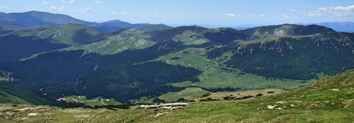
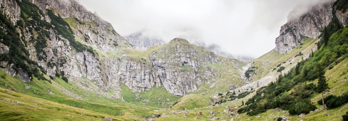
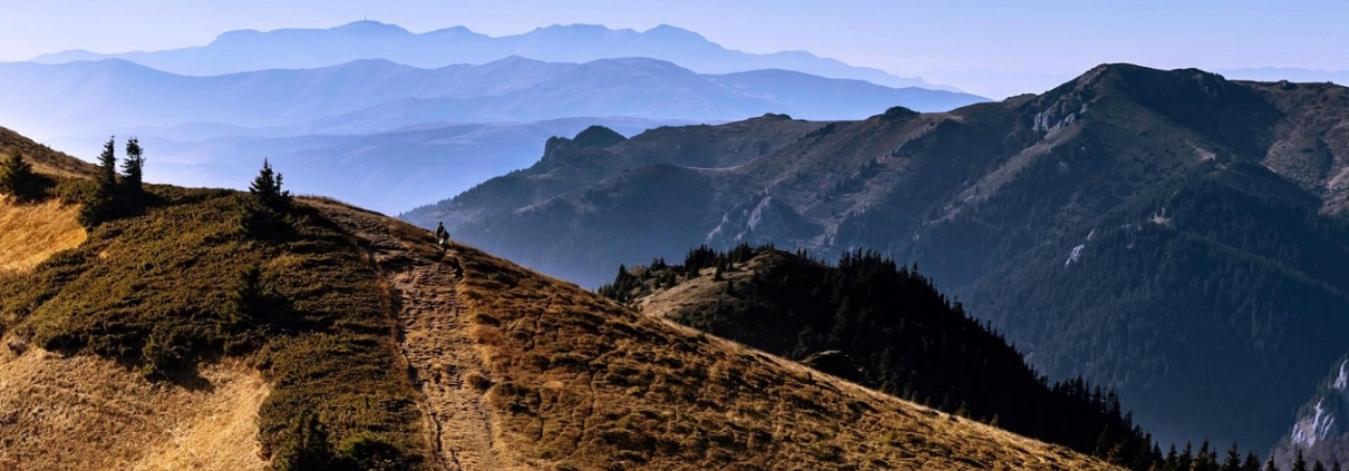
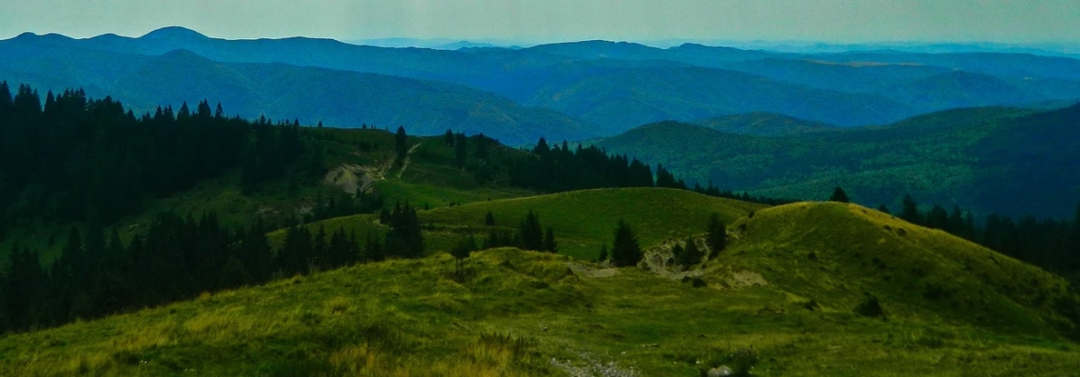
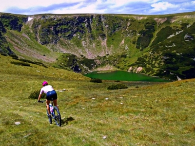
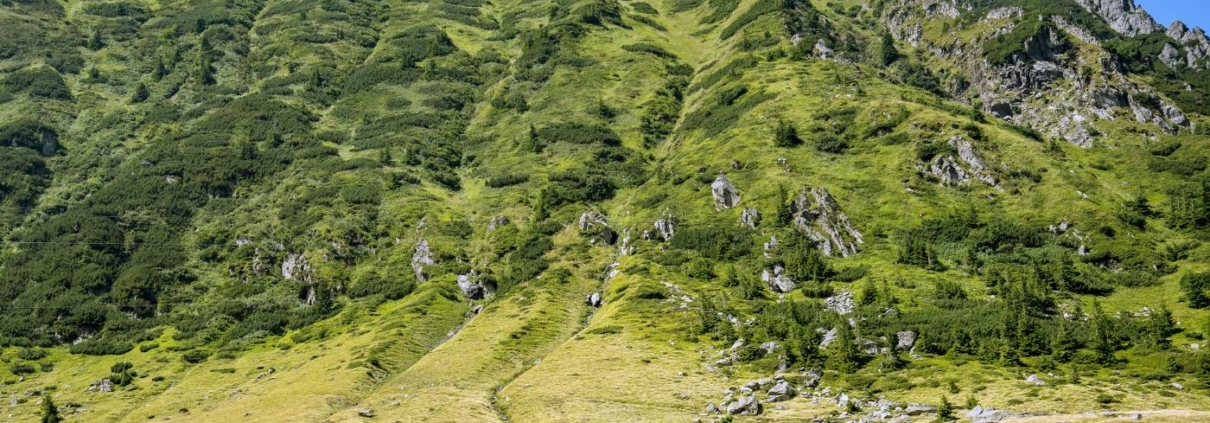
Lake District Epic
There are some days in the mountains that are truly special. Tackling the English Lake District in winter produces such days. Follow Rich Duckworth on this epic Lake District mountain bike route and take your own adventure!
Into the Fagaras Mountains
This short mountain bike route into the forest close to the historic medieval city of Sibiu in Transylvania, has some testing technical sections and steep climbing. It’s a perfect technical trail ride for a spring or summer spin.
Route Information
Sitting nestled close to the Fagaras Mountains, historic Sibiu is a great base for both road and mountain bike trips. This nearby route from the village of Avrig, takes you along steep and technical trails in the forests, exploring the lower Fagaras mountain biking opportunities.
Stats: 40.7 km and 988 metres of ascent
Refreshments & Where to Stay
Nearby Sibiu has all that you need for your stay, and you can fly in to Sibiu international airport too. There are lots of accommodation choices at all prices. There’s also a wealth of great coffee shops and restaurants to eat at, and lots to explore on foot. The historic centre is one of the most complete medieval cities in Europe and has superb hotels and AirBNB choices to suit all budgets.
Character
This is a short but testing forestry mountain bike trail near Sibiu, with some great technical sections and lots of descending, after the steep inital climbing 😉 It’s a useful spring and summer mtb route for a morning or afternoon ride, before relaxing in this unique area of a Europe – transfixing Transylvania.
Route
1. Unless riding with a local guide, you will need to follow the gps for this route into the hills. Head out of Avrig on the trail marked ‘105F’, passing Cabana Valea Avrigului Ovidiu after a short distance. Continue on,passing the happily named ‘Cabana Smiley’ and several other accommodation opportunities.
2. At the timber structure of ‘Gura Jibrii’ follow the gravelled trail into the trees (10.6 km). The trail climbs and follows the ridgeline in the forest, passing the cabin ‘Anna Charisma’ at 14.6 km.
3. At the 18km point, turn upwards and right, heading away from the river and climbing through trees to the high point, then descending and passing the track junction in the trees and continuing down in the direction of Marsa.
4. At 20.4 km stay on the right hand track and continue down as the trail becomes technical and skirts theforested hillside to Marsa. At 26.5 km the trail levels out for a short distance, descending again after 29 km, as it drops to Marsa.
5. Now take the open trail as it winds its way back to Avrig and the finish. Pack the bike away and drive back to Sibiu for some refreshments and evening exploring.
Click below to download GPX file
Avrig & Lower Fagaras Mountains
This short mountain bike route into the forest close to the Transylvania mountain resort of Busteni, has some testing technical trails and is perfect for a spring or summer spin.
Route Information
Busteni is a perfect mountain sports resort in Transylvania. This short mountain biking route has lots of technical features and some great descending in the trees to keep you interested.
Stats: 30km and 1,688 metres of ascent
Refreshments & Where to Stay
Nearby Brasov has all that you need for your stay, and you can fly in to Sibiu and it’s international airport. There are lots of accommodation choices at all prices. There’s also a wealth of great coffee shops and restaurants to eat at too, and lots to explore on foot. The historic centre has superb hotels and AirBNB choices to suit all budgets. Busteni itself is a good mountain resort, with cafes and accommodation choices.
Character
This is a short but testing forestry mountain bike trail near Busteni, with some great technical sections and lots of descending. It’s a useful spring and summer mtb route for a morning or afternoon ride, before relaxing in this unique area of a Europe – transfixing Transylvania.
Route
1. Heading out from the Gondola station at Busteni,follow the gpx as it guides you on the trail above the town, heading toards the Malaiesti Cabin, ignoring track junctions left at 4.9km and stay heading towards Poiana Coștilei.
2. The steep start eases at 5.9km for a short distance, before ascending again. At 8.8km stay right and sweep away from the high valley, then turning left at Poiana Pichetul Rosu (Red Piquette Glade) 9.9km and climbing as the trail twists towards the cabin.
3. The high point is reached at 12.9km and you begin descending to the cabin, but take care to stay on the right trail, avoiding (obviously!) the climbing ladders and boarded track in this area on the more technical hiking trails.Head down towards the Ghimbasel River, crossing this and passing close to the Cabana Diham at 19.3km.
4. Now follow the forest track that heads thrugh trees and picks up the Valea Cerbului River, as the trail descends back to Busteni.
Click below to download GPX file
Brasov to Rasnov
Route Information
Stats: 26km and 1038 metres climbing (Hard Route)
Refreshments & Where to Stay: Busteni is a good mountain resort for facilities, and nearby Brasov is excellent for all of your needs, and you can book a great place to stay and enjoy the superb trails nearby. It’s a tough mountain route, so please take sufficient drink and snacks with you, although mountain cabins will have options, they are limited.
Character
This area is wild and beautiful, with natural rugged forest single track trails in the forests. The route is suggested with a gondola start to make the most of the rolling trails and to really enjoy the steepand technical descending.
Route
1. This is a route into mountain forests, so you really do need to follow the gps file to stay safe. There are some technical sections and you need stay on course.
2. Take the Gondola from Busteni to the Bucegi mountain tops and then pick up the trail signed to Omu Peak. After a short distance you will see the best known rock formations on the Bucegi Plateau: the Babele and the Sphinx. These megaliths are modeled mainly by wind erosion. The Sphinx, named after its shape that resembles a man’s head, is 8 meters high and 12 meters wide.
3. The rough but wide track road continues about 2 km and at the mid-distance, it goes by the Salvamont Centre Busteni. You leave this road that goes to the Costila Relay and continue on the large path, marked with yellow line, road that goes on a level curve.
4. In a short time you will arrive at the Cerdac, the place where the path splits in two. On the left, the winter trail goes up and the summer trail continues straight ahead. The summer path is exposed and narrow, under the path there is the Valea Cerbului Steep. The track is rocky and tough and care should taken, but at the 5.8km point, you will reach the Omu Hut.
5. From the Omu Chalet you follow the red line marking, on the old road of the frontier guards, the former frontier path between the Transylvania and the Vechiul Regat. The next few km, towards the Strunga Saddle, the trail is rough and less frequented by tourists, but has excellent sections of technical mountain singletrack as it drops down to a track junction at 11.8km.
6. Climb back towards the gondola station above Busteni, but this time, then take the track right, along the edge, to the 17.6km point, turning down towards the Piatra Arsa Cabin, passing this and continuing down passing the Cantonul Jepi cabin too.
7. At the 20km point, the track steepens and becomes technical at times as you enter the forests again and weave your way down the mountain back to Busteni on techinal forest tracks. There are track junctions that can take you towards the water cascade, but avoiding this track will help to avoid the tourists on foot.
Click below to download GPX file
Route Information
Stats: 36km and 1795 metres climbing (Hard Route)
Refreshments & Where to Stay: Magura is a good mountain resort for facilities, and nearby Brasov is excellent for all of your needs, and you can book a great place to stay and enjoy the superb trails nearby. It’s a tough mountain route, so please take sufficient drink and snacks with you, although villages on the edges will have options, they are limited.
The adventurous can also book at stay in the mountains at Cabana Curmătura, which is along the start of this route.
Character
This area is wild and beautiful, with natural rugged forest single track trails in the forests. The initial climb is extremely steep and there may be some bike hiking on the tough climbs. However, the awesome descents are truly rewarding.
Route
1. This is a route into mountain forests, so you really do need to follow the gps file to stay safe. There are some technical sections and you need stay on course.
2. Setting off from Magura, a narrow trail between houses sweeps down to the gravel road and on for 1.9km, to where cars park at the trail head area. This is also a useful place to park and start from if not staying in Magura. However, starting the ride from Magura allows you to warm up before the steep climbing begins.
3. From the car parking area, follow the signs into the trees and uphill. The trail crosses a meadow at 3.8km and heads into tree cover once more, before reaching the high point at the Curmatura hut at the 6.3km point. You can get food and refreshments at the hut and even book accommodation if you’re adventurous.
4. Continue past the hut and descend for 3km to Valea Cheli where climbing begins again. At the 11km point a junction of tracks is met – ride along the right hand track, Valea Prapasiilor, crossing open mounatin meadows after 1.5km.
5. The trail rolls and climbs to a high point at 19.6km shown as Saua Joaca in open meadows, where a right right hand track sweeps around and continues to descend across meadows to the forest, eventually taking you above farm meadows and climbing back into the trees at the 22km point.
6. Climb for 1km and then descend at speed for 3km, passing the initial track junction from the ride out, as you now simply follow the trail back towards the Curmatura hut once more, where you’ll have earned cake and coffee. It’s your choice whether or not you stay in the hut or descend back to Magura.
Click below to download GPX file
Forests & Hills
Route Information
Stats: 49km and 1431 metres climbing (Hard Route)
Refreshments & Where to Stay: Busteni is a good mountain resort for facilities, and nearby Brasov is excellent for all of your needs, and you can book a great place to stay and enjoy the superb trails nearby. It’s a tough mountain route, so please take sufficient drink and snacks with you, although villages on the edges will have options, they are limited.
Character
This area is wild and beautiful, with natural rugged forest single track trails in the forests around Fetifoiu ridge, steep and tough climbs and awesome descents. It’s a real lung busting ride, but with the type of trails that will leave you smiling, with the long singletrack descent alongside the river to Busteni.
Route
1. This is a route into mountain forests, so you really do need to follow the gps file to stay safe. There are some technical sections and you need stay on course.
2. Setting off from Busteni, there’s some road riding to get into the ride, so follow the roads to Azuga and ride this this small town.
3. Head out of Azuga towards and past the telegondola and head into the woods following the GPS, climbing steeply. The trail summits, before then twisting and turning at speed down towards the Azuga River.
4. Cross the river and follow the trail that climbs northwards, until a clearing and buildings at 18km. Take the left hand fork, which continues to climb as it skirts the edges of the valley along a track (Limbasel). At the 23km point a track junction it met near to high point – turn left and then exit this track onto singletrack on the right at 23.6km.
5. This singletrack descends to the village of Predeal, which you ride through,onto the DN1 south until the edge of the village. Turn right onto the DN73A at the 30.4km point and follow this for 4km, then exiting onto the trail on the left 34.6km.
6. Follow this well defined track which climbs to the 39.2km point,where track junctions are met, and sweepround right to a point at 40.2km where hairpin tracks above on the left should be taken.
7. At the 42km point this track starts the long descent, twisting down towards Busteni some 7km away, following the Valea Cerbului River back to town.
Click below to download GPX file
Route Information
Stats: 34km and 1659 metres climbing (Hard Route)
Refreshments & Where to Stay: Busteni is a good mountain resort for facilities, and nearby Brasov is excellent for all of your needs, and you can book a great place to stay and enjoy the superb trails nearby. It’s a tough mountain route, so please take sufficient drink and snacks with you, although villages on the edges will have options, they are limited.
Character
This area is wild and beautiful, with natural rugged forest single track trails in the forests around Fetifoiu ridge, steep and tough climbs and awesome descents. It’s a real lung busting ride, but with the type of trails that will leave you smiling, with the long singletrack descent to Busteni.
Route
1. This is a route into mountain forests, so you really do need to follow the gps file to stay safe. There are some technical sections and you need stay on course.
2. Setting off from Busteni, climb the single track through the trees for 3.5km, where it then steepens until the 6km high point.
3. Descent to the 13km point, where a track junction is met, turning left onto the track (Strada Glaiariei) and then following this as it climbs steeply. At 14.1km take the left hand fork and contiue on this obvious trail to the 16km point.
4. At 16km turn onto this narrow track in the trees on the left and continue to climb, coming out of the trees at 17.7km and seeing farm buildings. Pass through the open area, back into trees and continue to climb to 20km, where the track finally descends and twists downhill, crossing an earlier track at the 23km point, before turning left at the 23.7km point into the narrow track.
5. This climbs through trees to 26.5km, opening out from the trees, where you turn right and climb for a further 1km before finally descending again on the tough tracks in the forests, then finding the flow down back to Busteni.
Click below to download GPX file
Transylvania is home toour editor, Larisa Chinces, who rides and races mountain bike in these beautiful mountains. With endless rugged trails through magical forests, Transylvania mountain biking will live with you forever and you’ll want to return time and time again.
A rolling Transylvania mountain biking route in the mountains above historic Sibiu, among beautiful forested hills at Paltinis.
This natural trail is taken from the 2018 Triada MTB Series, one of the very best in Romania, and it’s an awesome adventure along the beautiful and technical mountain biking trails that lie in the Carpathian mountains.
Cycling in Transylvania and Romania is a delight. There is so much history around you and the beautiful landscapes. Sibiu is at the heart of cycling in Transylvania, sitting beneath the Carpathian Mountains, it has some of the best road cycling and mountain biking in Romania, and indeed in Europe.
Distance & Ascent: 70 km & 3100 metres of climbing
Facilities: Limited at Paltinis, but ample in nearby historic Sibiu. Airbnb have a great selection of properties to choose from, all exceptional value. Choosing Sibiu as a cycling destination is something that you all should do, taking time to stay and to explore the medieval history of this beautiful city.
Route
Click below for gpx file
A favourite route into the Transylvania mountains for our editor, Larisa Chinces, this is Transylvania mountain biking at its best.
Route Information
Stats: 34 km and 472 metres of ascent
Refreshments
Nearby Sibiu is our chosen base for this ride out into the hills. It has ample accommodation places, and lots of choices of restaurants. Transylnavania is a great mountain bike location and Paltinis is a super introduction.
Start and Finish: Paltinis near Sibiu, Transylvania.
Character
The route I’ll take today is easy, relaxed and disconnected from the urban environment. The route starts from Sibiu, and until reaching Paltinis there is a distance of about 30 km that can be reached by car or by bus (about 15 lei / ticket and 40 minutes distance). The Paltinis-Vf. Cindrel is about 5 hours and during the summertime you have to have a raincoat because the weather is quite changing.
Route
1. From Paltinis, it is 1 hour to Poiana Gaujoara, through a beautiful forest like in fairytales. The route is single trail and the difficulty is medium. Poiana Gaujoara is a glade full of vegetation in the middle of a spruce forest.
2. Now, it’s uphill to Batrana (1911 m), where a weather station is located. From the alpine hut, the route is simplified because it is only on the crest in the sun. From the trail you can see the Fagaras mountains behind you and on the left you can see the crest of the Lotru mountains.
3. The road to the Canaia hut has a low difficulty level and wonderful scenery to stop and take in.
The trail stops at the Canaia hut, where you need to be aware that it’s not open permanently, but only if the landowner is announced in advance. So do try to check with locals and in in nearby shops and hotels. If open, there you can sleep, rest and eat before setting off on the rest of your Romanian adventure.
4. From here to the final destination of the trip is approximately 1 hour – one half hour. The trail passes through a juniper, followed by the Cindrel Nature Reservation, which during the summer, when the peony is blooming, is covered with a pink/violet color to a very pleasant honey, a gorgeous landscape from which you hardly go away. Then it’s an uphill ride or hike to the Cindrel Peak, where there are a few push bike sections for everyone!
5. However, as much as you liked the route, you will love the top scenery from Cindrel Peak (2244m) where the view leaves you breathless, and thankful that you climbed up.
6. Now, all that’s left is to pick your point of decent, and enjoy the flying speed as you race through our amazing mountains, hopefully dreaming of further visits and new routes to explore – you’ll always be welcome, and there’s so many mountain valleys to choose from!
click below for gpx file
Pendle Circumnavigation, Lancashire
Route Information
Stats: 19 miles and 1950 feet of ascent
Shop in Sabden, toilets in Newchurch and Barley, pubs in all the villages.
Character
A great tour around the rim of Lancashire’s great whale-back. There are long stretches of tarmac but this matters little as the landscape is beautiful and the lanes quiet. A longer loop could be made including a detour into Ogden Clough.
Two snippets of autobiographical detail – Pendle has become a bit of an obsession, even inspiring the co-writing of a whole book. The other is the verb “circumnavigate.” It’s more than just a pompous way of saying “go around”. When we were kids, we didn’t just go for walks “around” Buttermere, Wastwater or Derwentwater; we circumnavigated them. The distinction was crucial, making us mini-Magellans on perilous adventures. So shall it always be…
Route
1. Set off North-eastwards along the wood-lined lane through pleasant pastures to Sabden.
2. Turn left up the hill and climb with vigour until you see a fingerpost sign heading right. Look for the words “Concessionary Bridleway” – this is your passport and trumps the older “No cycling” sign.
3. Follow the bridleway on a contouring line until another fingerpost sends you steeply down to the right.
4. Join a lane and cross a stream, climbing up and to the left to gain a high terrace, mostly tarmac, that leads past New York Farm and on to Sabden Fold. It ends with a bridleway sign pointing right but disregard this.
5. Turn left at the end and climb steeply across the shoulder of Pendle, through Newchurch and plummet down to Barley.
6. Fork right where the road veers left in the village (another concessionary bridle path sign), and follow the lane down to the reservoir. Turn left here and follow this round to the right and down to the road.
7. Turn left and follow tarmac, going straight on at the atmospheric crossroads of Annel Cross – where Robert Johnson would have come to sell his soul to the Devil if he’d been born a Lancastrian. Now descend into the charming village of Downham.
8. Before you cross the bridge, turn hard left into a quiet lane, signposted to a car park. Snake up and right, past the caravan park, turning left at the signpost to Little Mearley Hall.
9. Gain another contouring terrace-line and follow this unerringly to the Pendle Nick road.
10. Turn left and climb (more vigour required) up and over the Nick, looking out for a bridleway
turning right, only 100 m after the summit.
11. Follow this track, descending gradually to the foot of the ridge and a left turn to regain the car.
click below for gpx file